Palace of Pena, Sintra, Portugal

What do you do when you want a peaceful cottage where you can escape the stresses of daily life? If you happen to be the king of Portugal, you renovate an old monastery into a romantic castle using bright colours and the ubiquitous glazed tiles (below).

This is what Ferdinand II (cousin of Prince Albert, above left) did in the first half of the 19th century in Sintra. Situated in a huge park reflecting the fashionable ’picturesque’ design style, the castle eschews all symmetry in favour of romantic towers, turrets, bastions and walls. The park also has a Moorish Castle, originally begun in the 8th century (above right).

All castles need a Great Hall, and this one is no exception – it was used for audiences and festivities (above). The royal family used the castle until the declaration of the republic in 1910, and since then it has been open to the public.

Previous posts:

University of Coimbra, Portugal

First founded in 1290 in Lisbon, the university moved to Coimbra in early 16th century, and was the only university in the Portuguese-speaking world until 1911. The university was founded by king Dinis, whose mortal remains were dug up (for research) recently, and, as is customary these days, a recreation of his facial features was made (below left).

As befits a long-time royal institution, the current Ceremonial Hall is the former throne room (above right). The old chemistry building houses the University Museum (below left), which has preserved a typical 19th century lecture hall (below right).

Although many of the current buildings are from 1940s and 50s (above left), the old part is from 17 and 18th centuries (title picture), and the University Museum

The crown jewel here is the Joanine Library (above), named after king John V who commissioned it in the early 18th century. It looks like he really respected books based on the library design – and just to make sure everything is still in order, he looks down from the wall on current visitors. Below left is the main entrance to the library, and below right some of the more ordinary shelves.

There are other old inhabitants of the library looking down on visitors, as there evidently still are bats that have been used for centuries to control moths and other pests dangerous to books. Some of the resident bat species are themselves protected these days.

Students have not always been famous for good behaviour, and thus you needed an academic prison to cool off hot heads (above left). Then you might go to the chapel to pray forgiveness (above right). Below are some of the black-robed (well-behaved) students on the steps to the Ceremonial Hall.

Previous posts:

Books in Chantilly

The Musée Condé at the Château de Chantilly outside Paris happens to own one of the best-known medieval manuscripts, ’Les très riches heures de duc de Berry’. As this well-known marvel needs to be rebound, there has been an exhibition around the famous illuminations depicting the months.

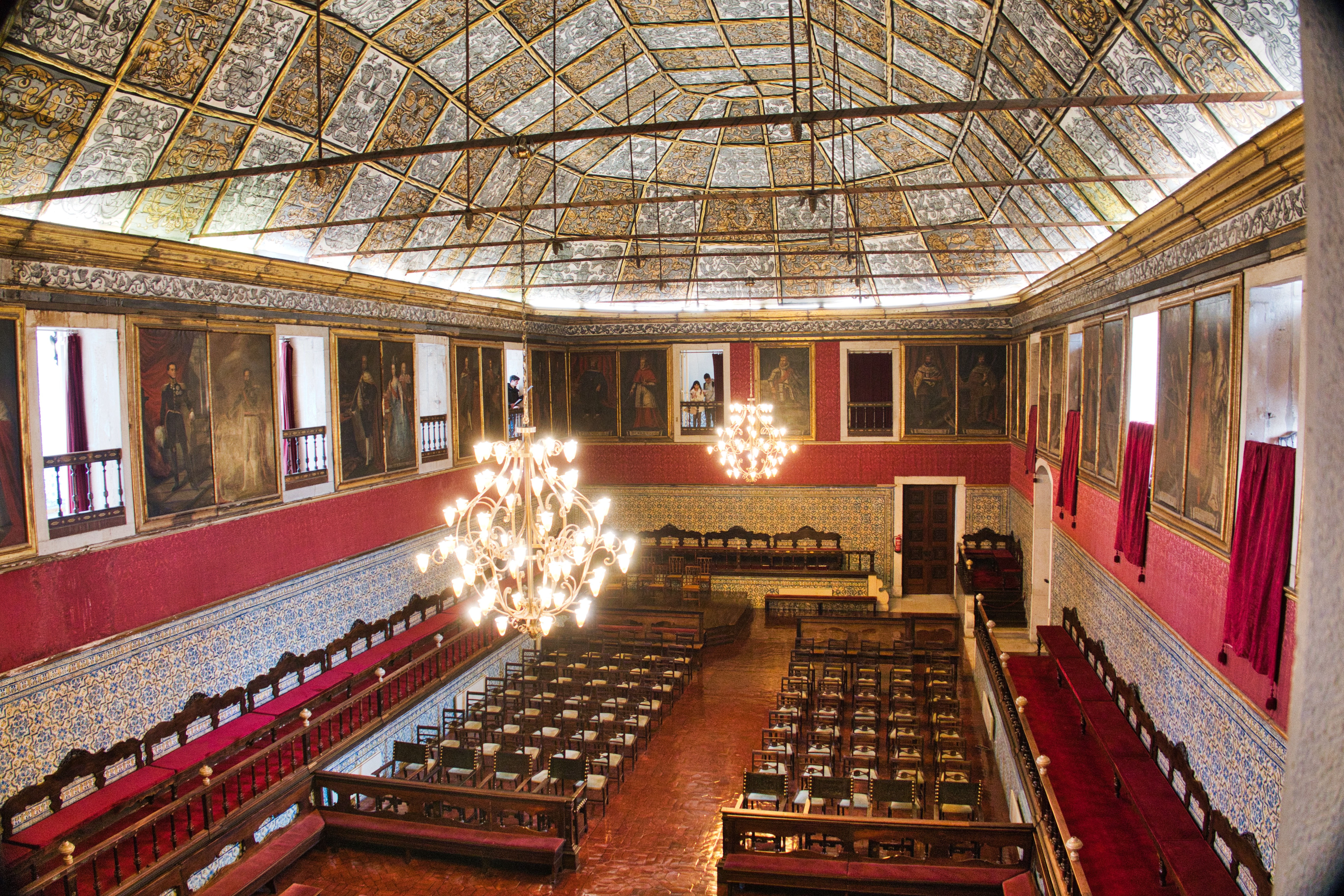
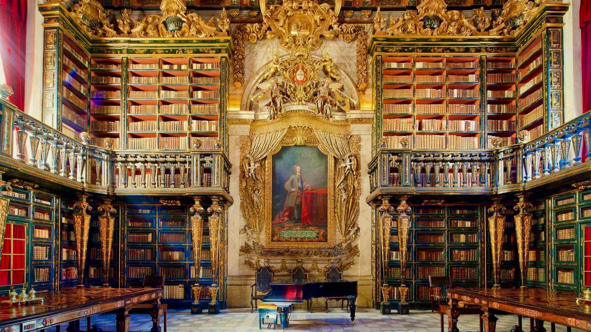
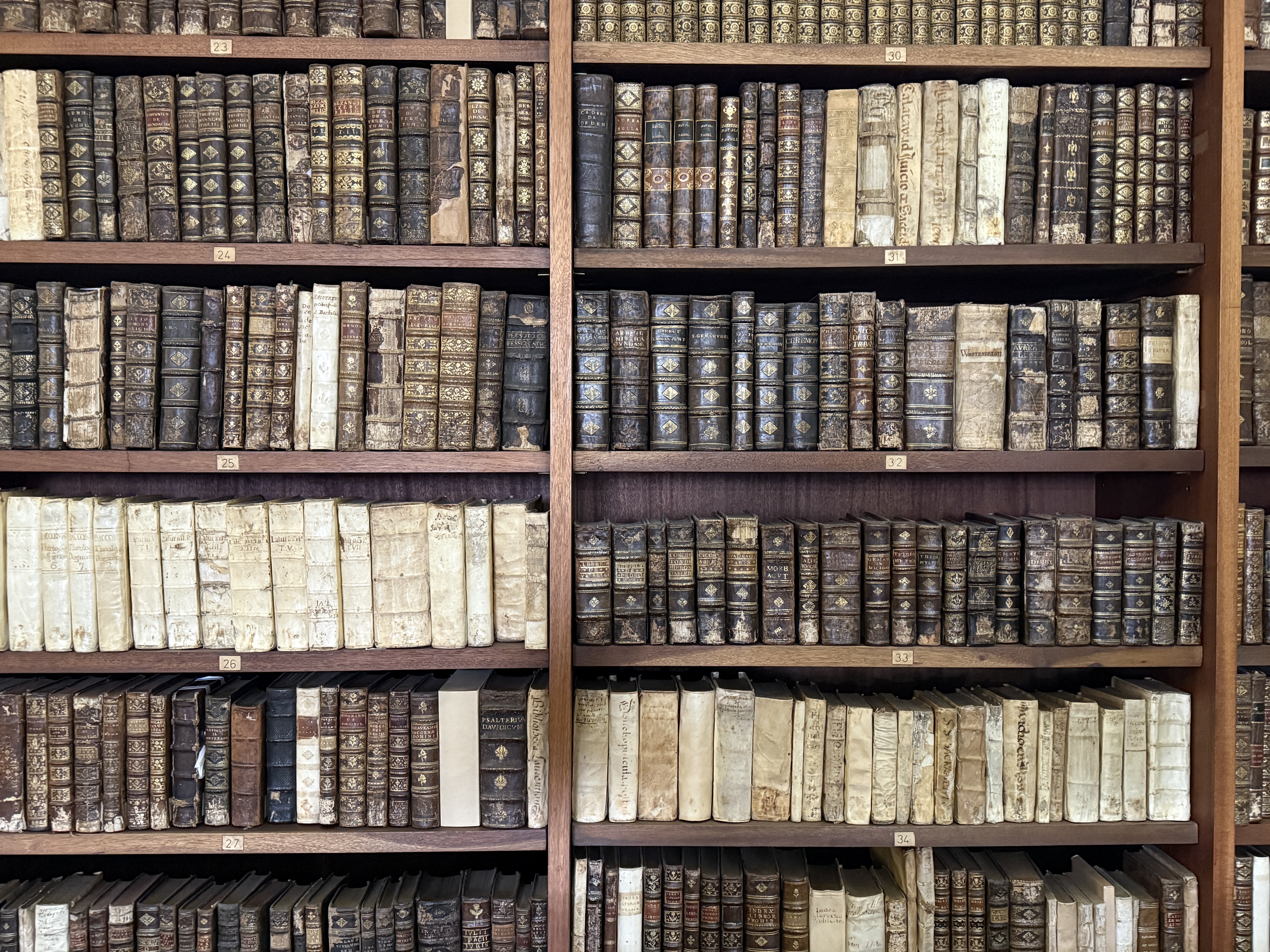
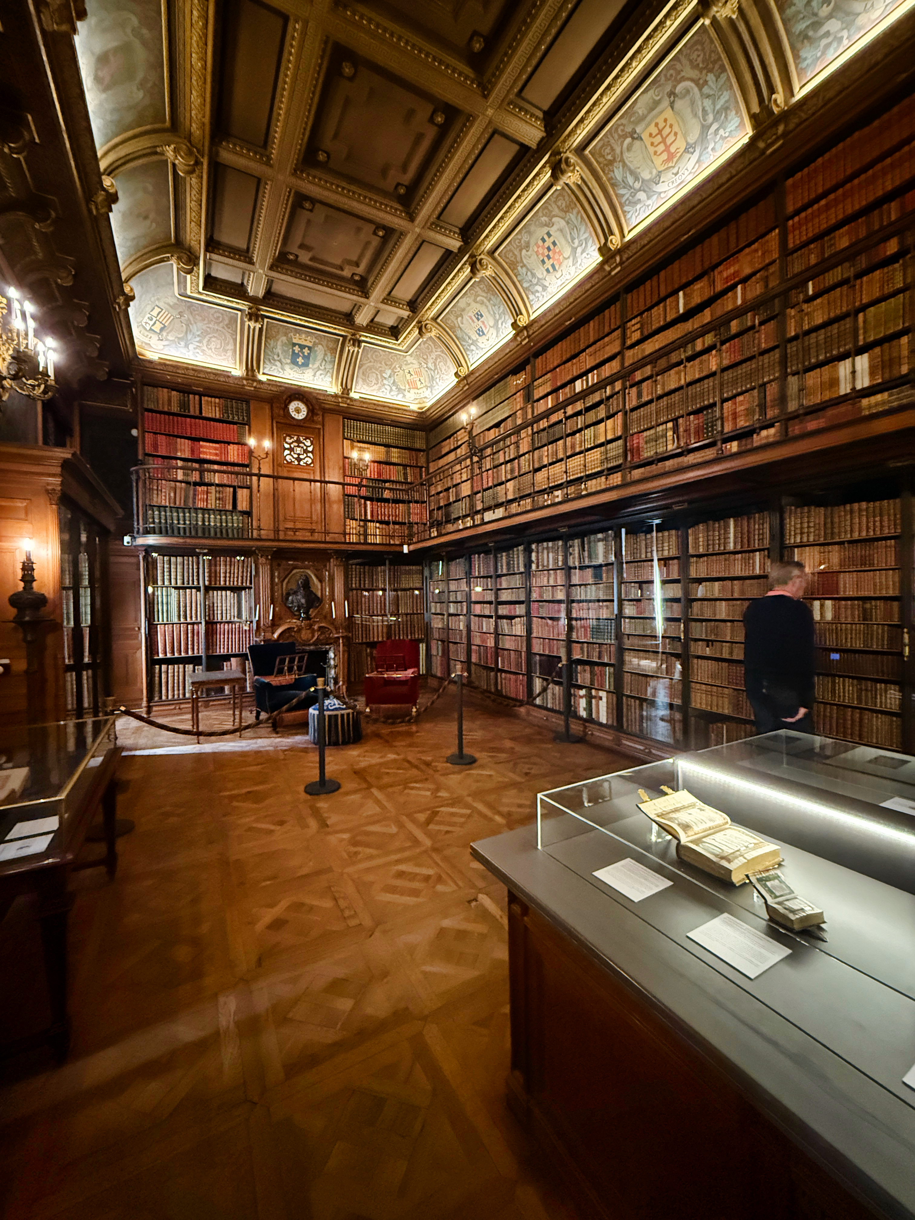
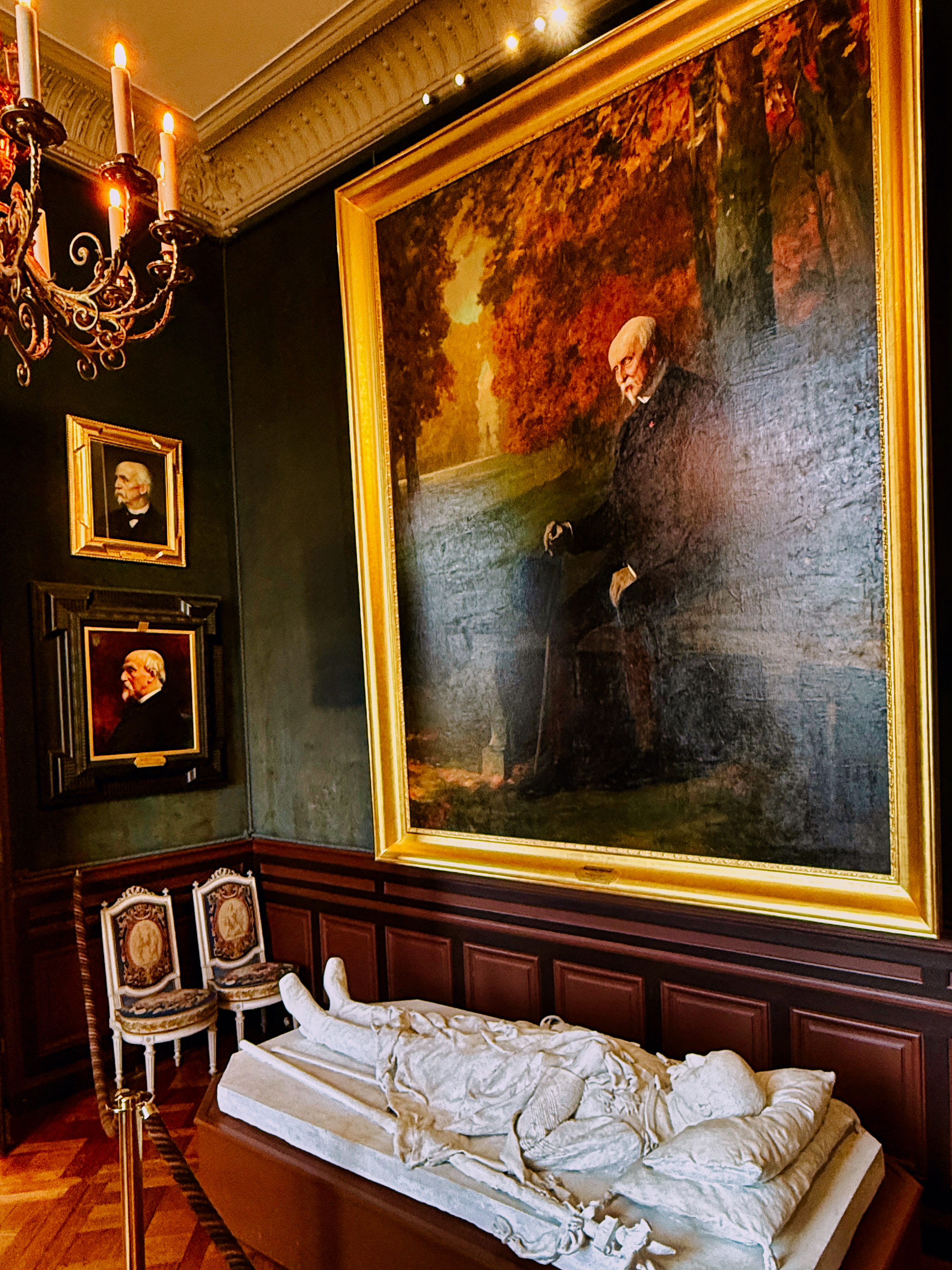
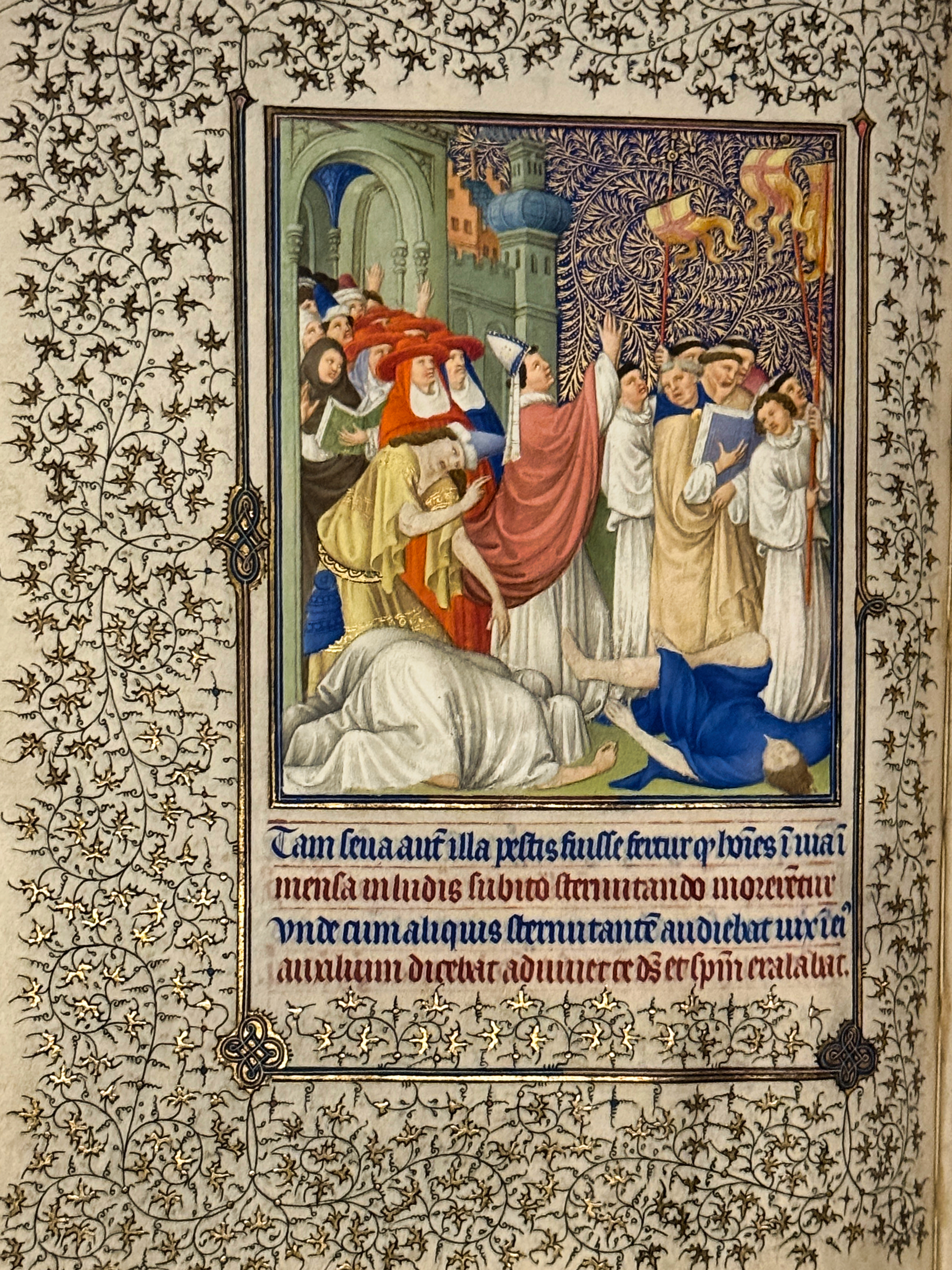
The château itself is mostly a reconstruction from the 19th century, when the duke of Aumale established his collection of books (the library above, with an illumination ’The Death of Uriah’ from a book of hours), paintings and furniture there. He left it all to the Institut de France that these days runs the show (portraits and an effigy of the duke below left).

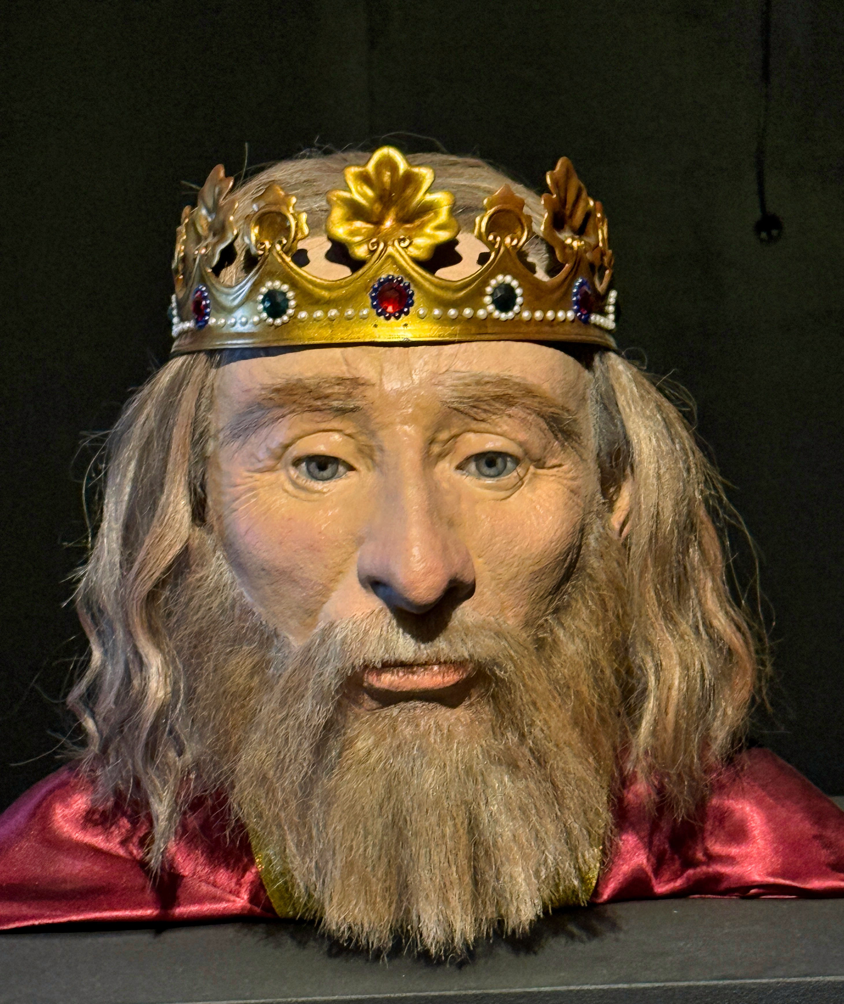
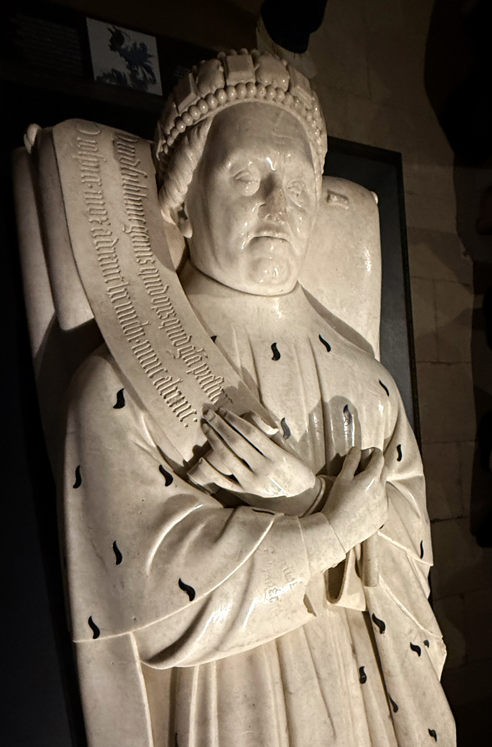
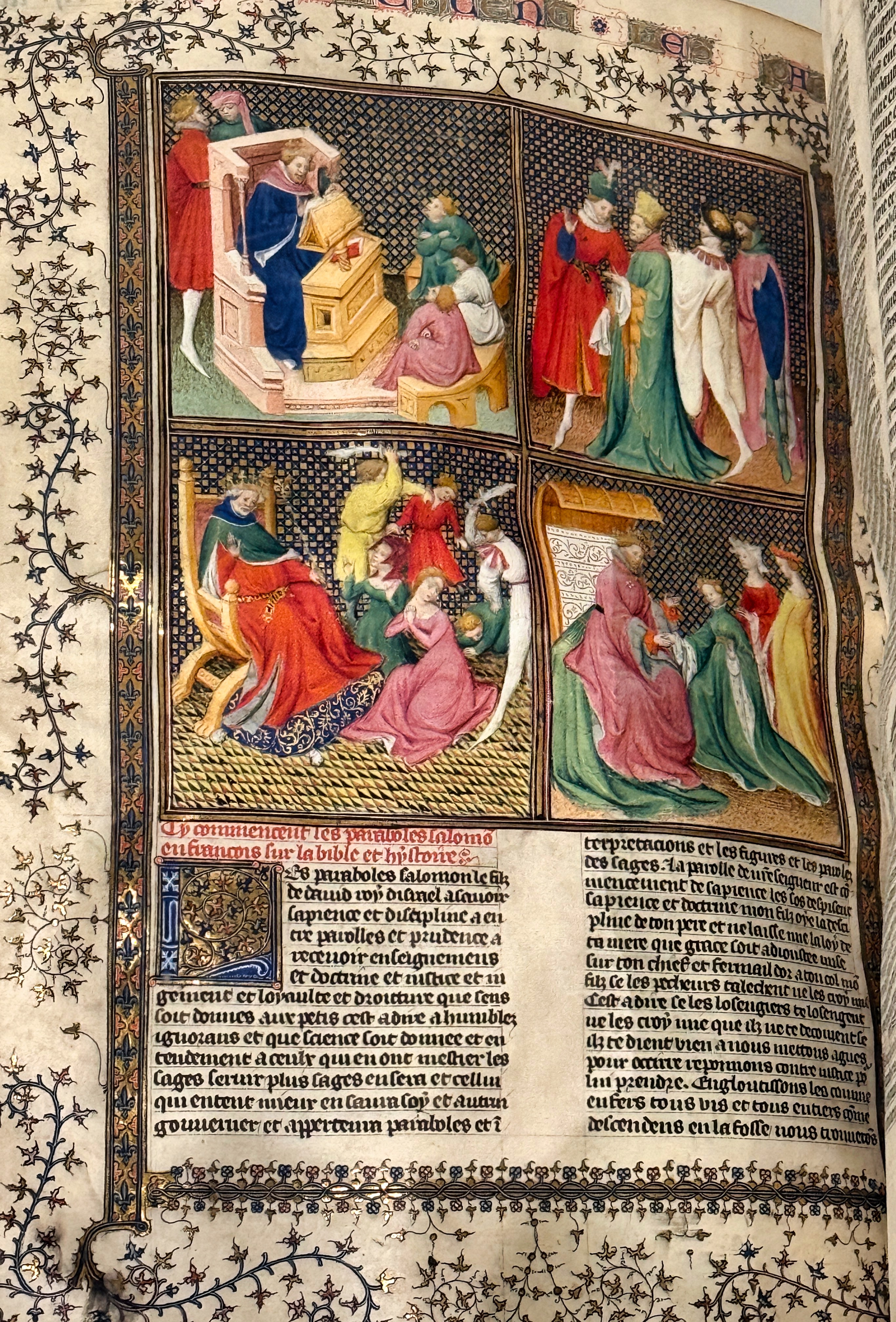
The exhibition of medieval manuscripts was built around the history of the duke of Berry (his effigy is above right), for whom the famous book of hours was made. Some of the manuscripts exhibited are below – left is a page from Wauchier de Denain’s ’Histoire ancienne jusqu’à César’ (1400) and on the right is a page from ’Grande Bible historiale compléte’ (1395-1400).

At the age of 69, the duke refused to die before he had the most beautiful book of hours. He employed three well-known illuminators from Flanders, the Limbourg brothers, to do the job. Beginning in 1409, they worked for seven years and finished 10,5 pages – and then the duke died. His inheritors were horrified of the cost and stopped the work.

In 1485, the duke of Savoy, the then owner, managed to finish the manuscript using another illuminator, Jean de Colombe. The book traveled through the courts of Europe until 1856, when the above-mentioned duke of Aumale, Henri d’Orléans, bought it for his collection at Chantilly.

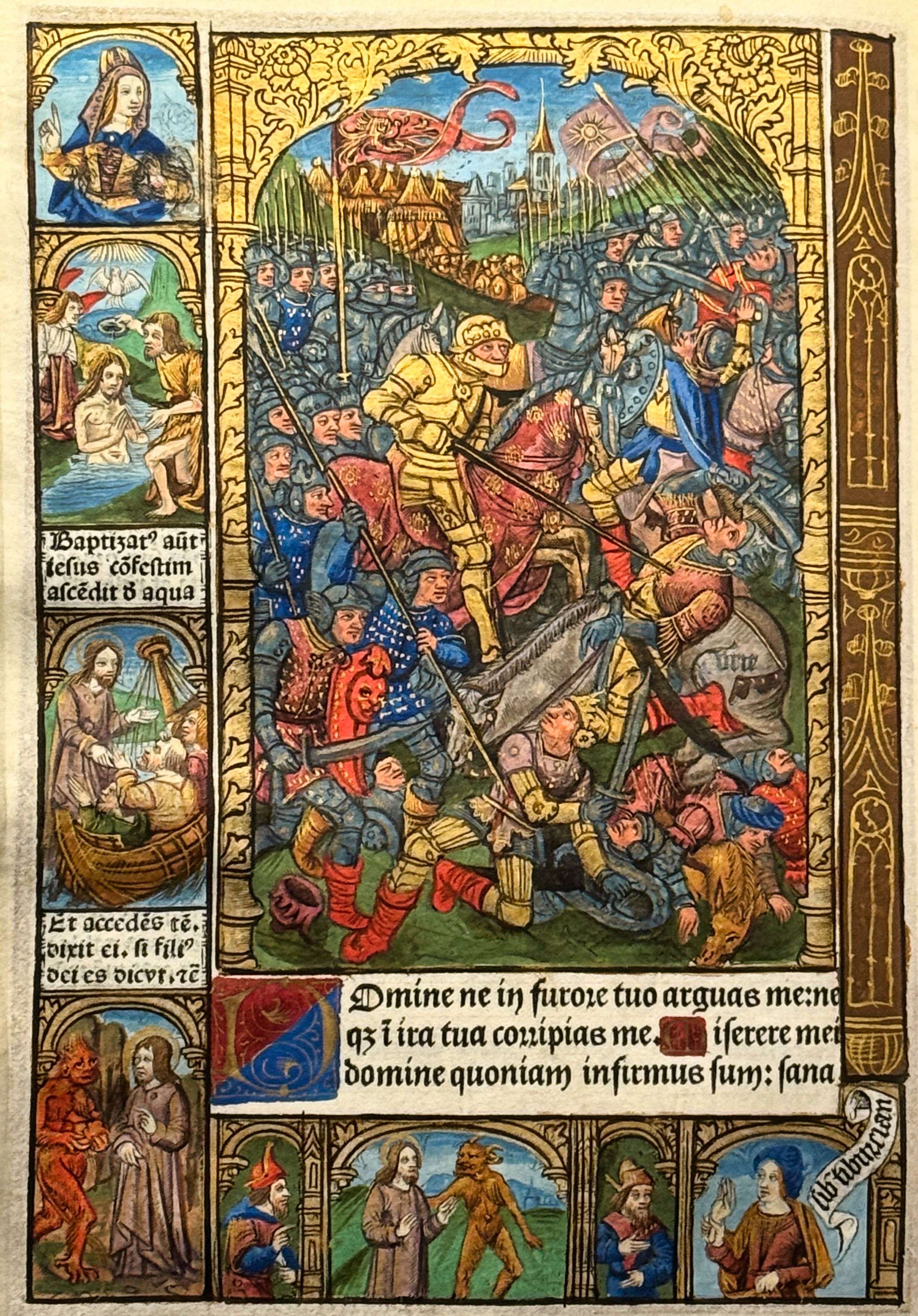
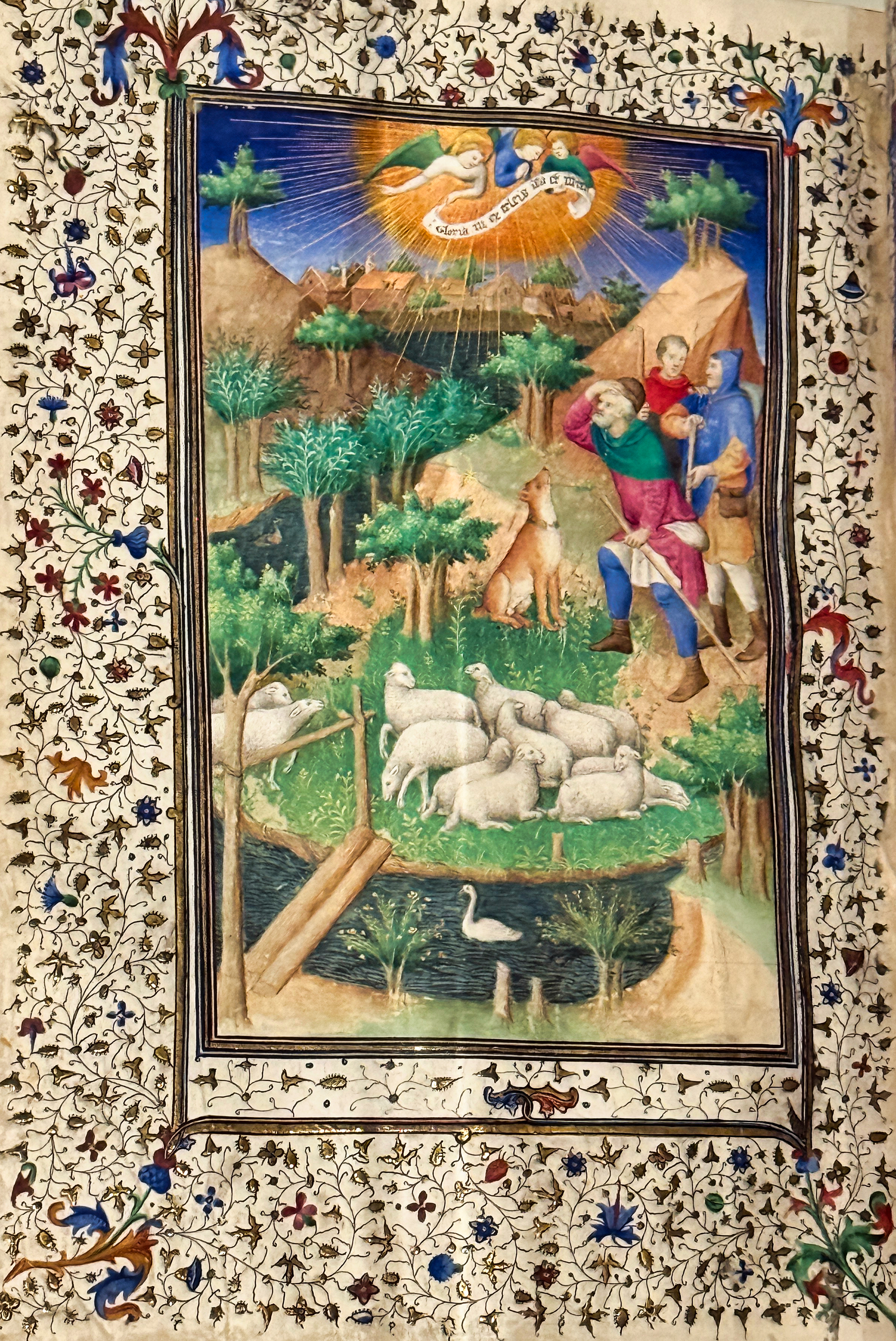
Books of hours included religious texts (prayers, psalms, devotional content for all days of the week) and a calendar, phases of the moon and signs of the zodiac. Wealthy nobles had usually several for varous purposes. Below left, an illumination from ’Heures de Notre-Dame’ and right, ’Belles heures de duc de Berry’.

Above left, a plate from ’Heures du Maréchal de Boucicaut’ (1408-1409) and right, from ’Très belles heures du duc de Berry’ (1402-1403).

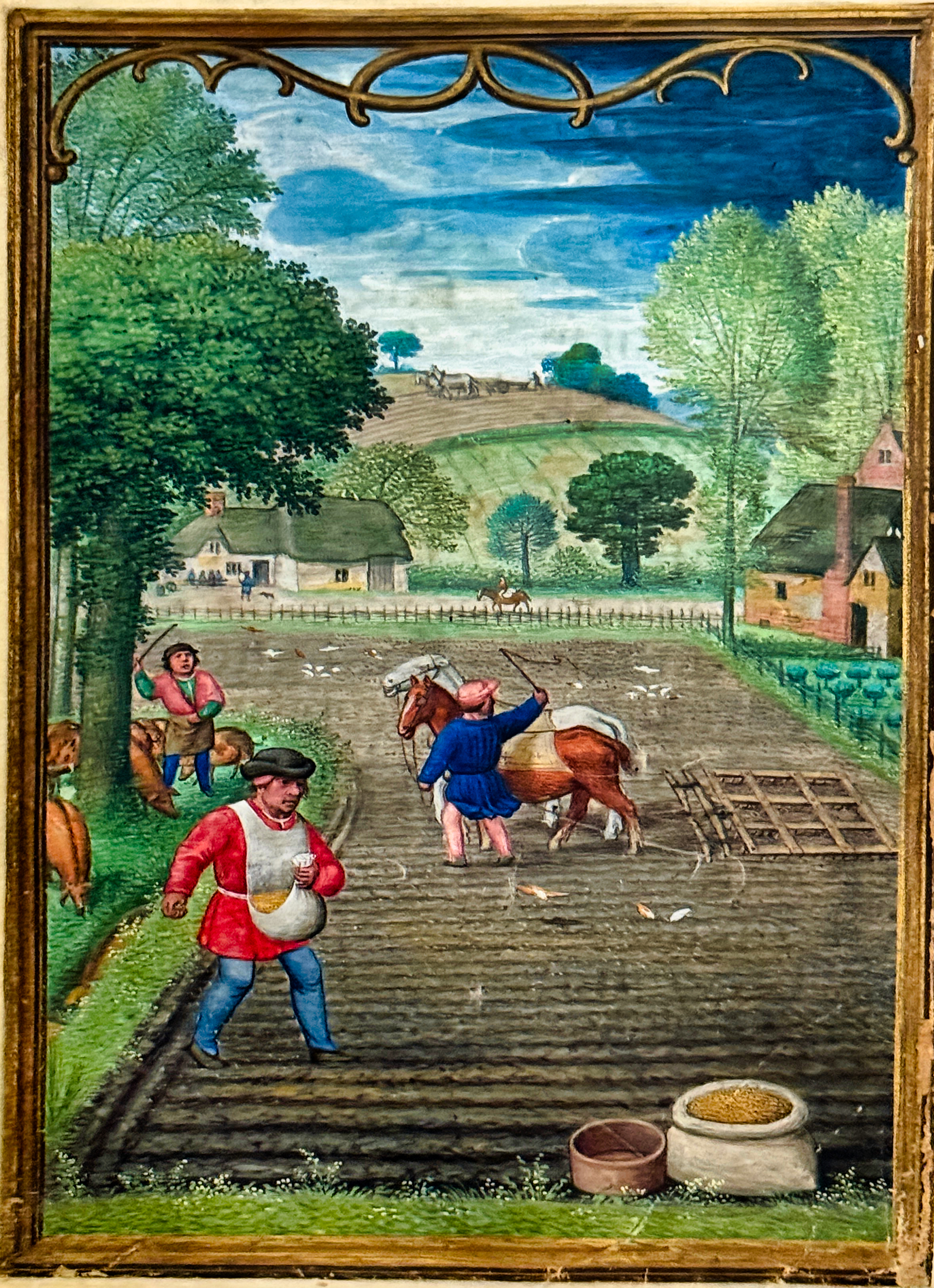
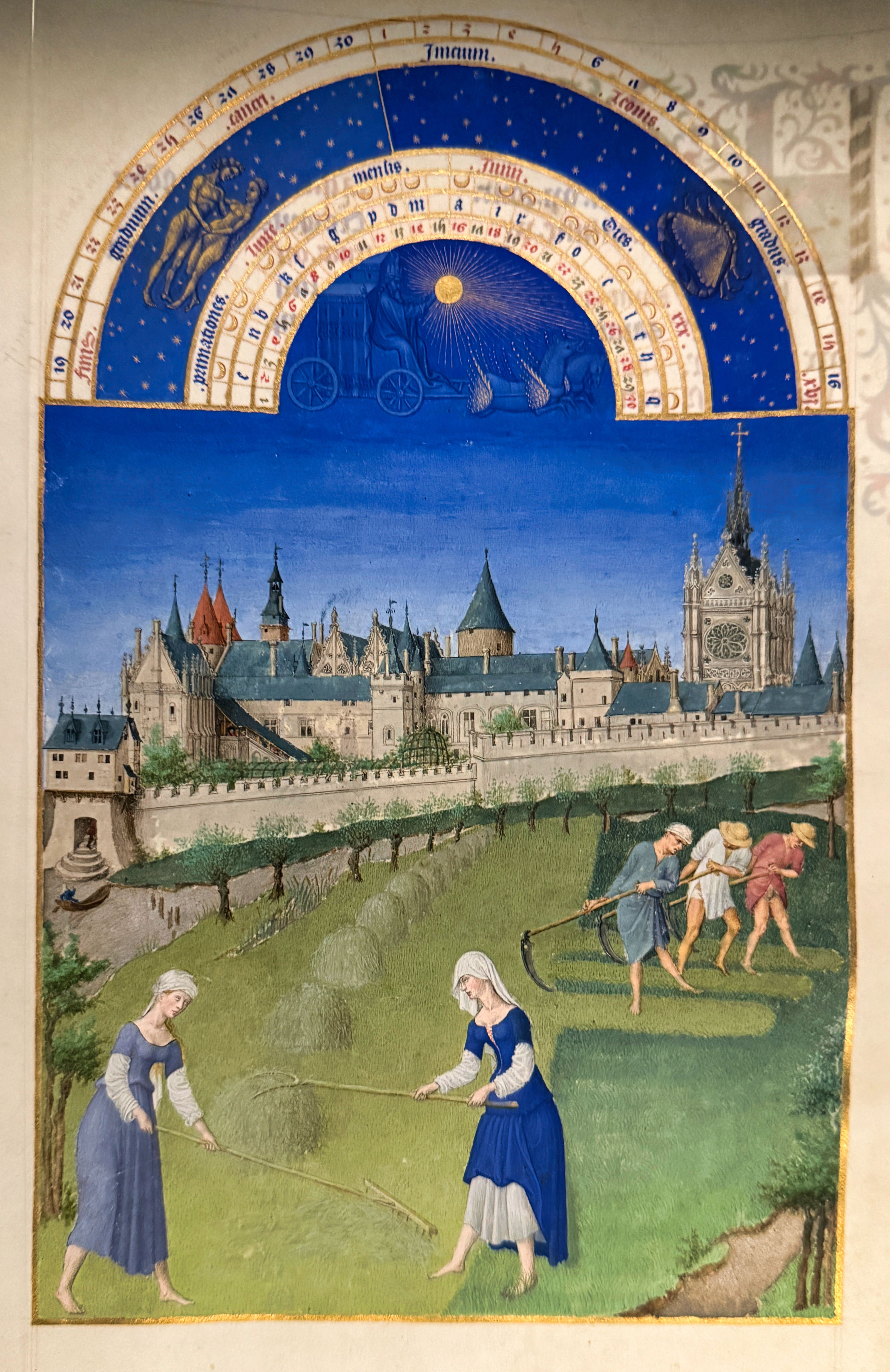
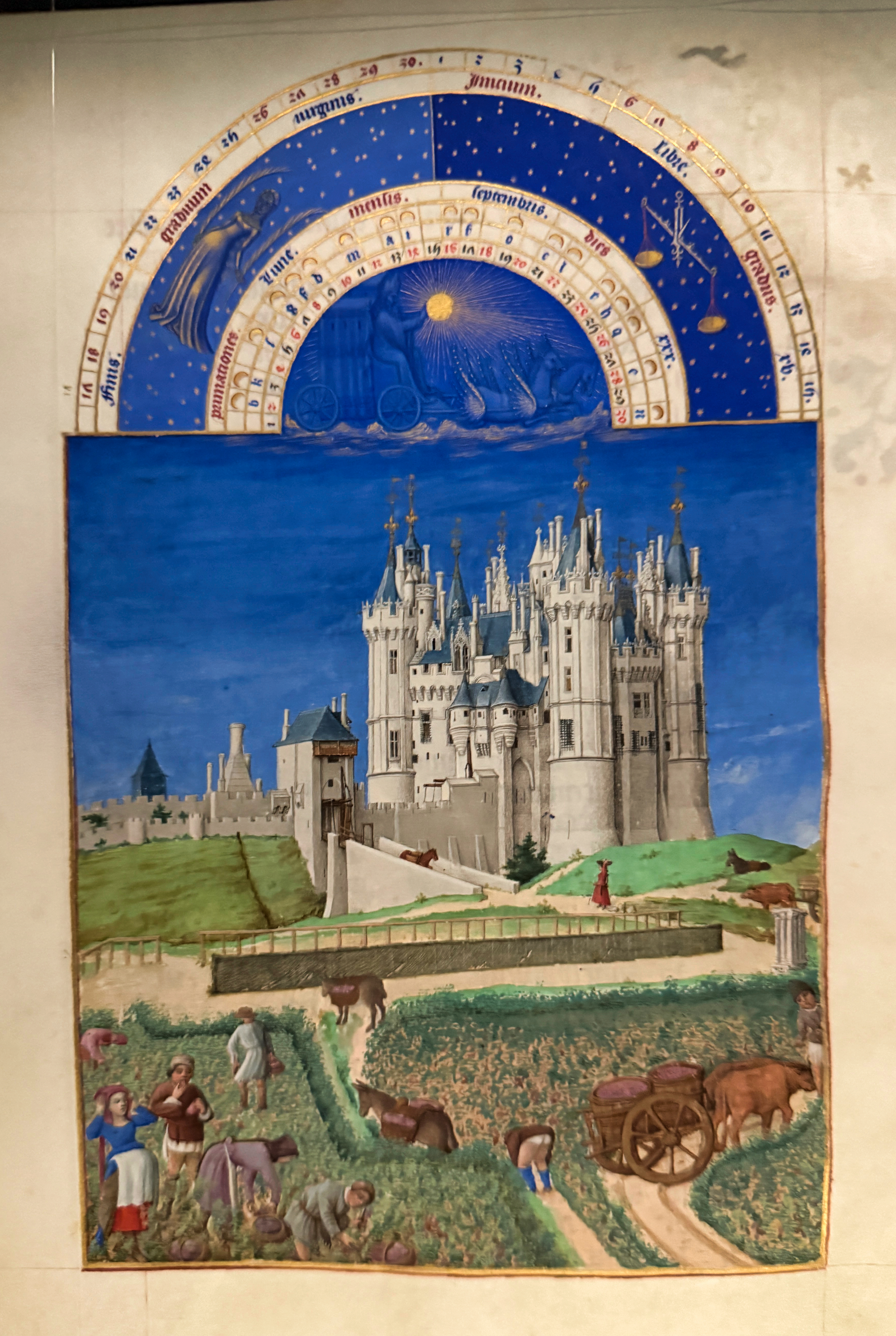
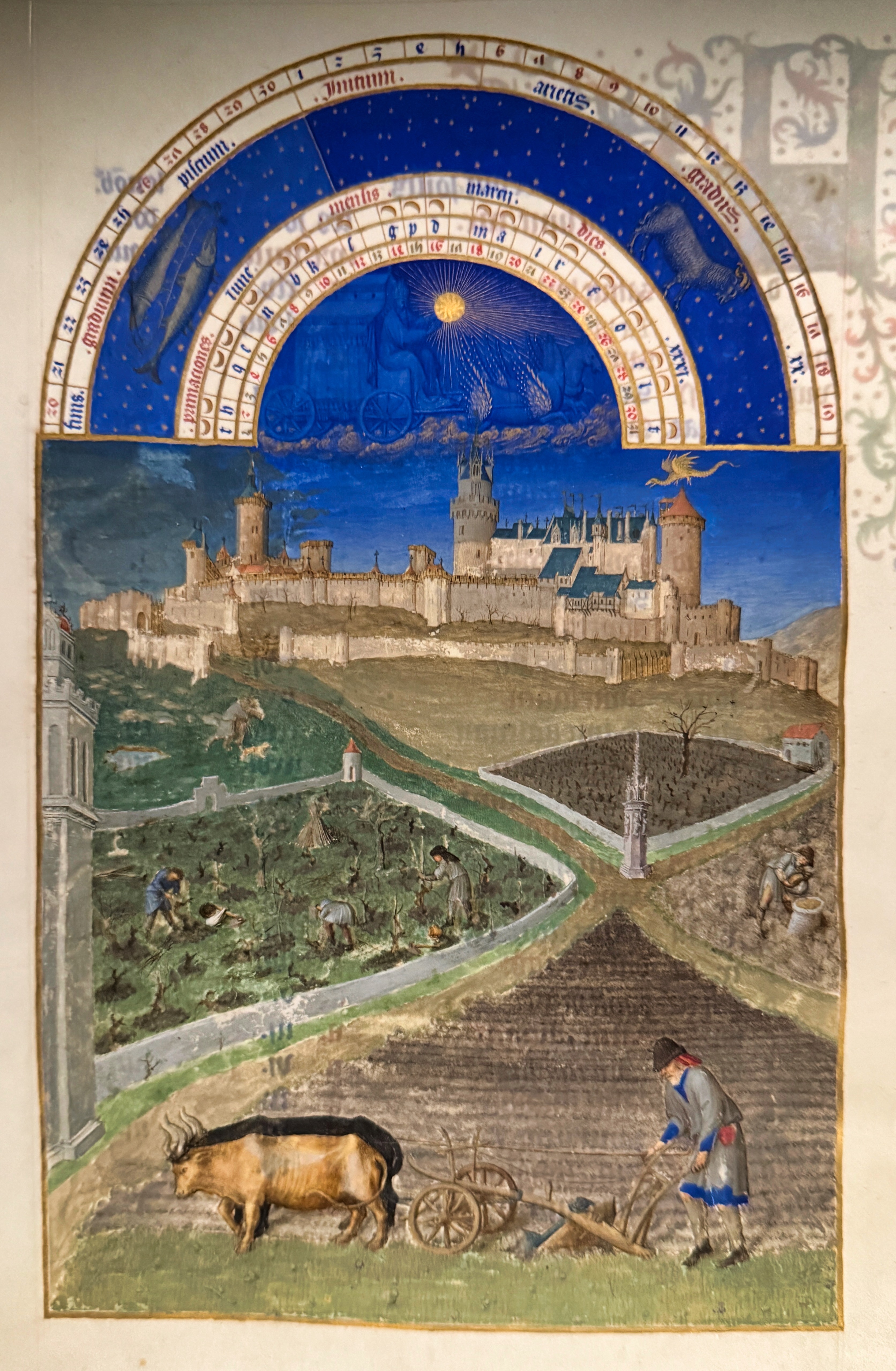
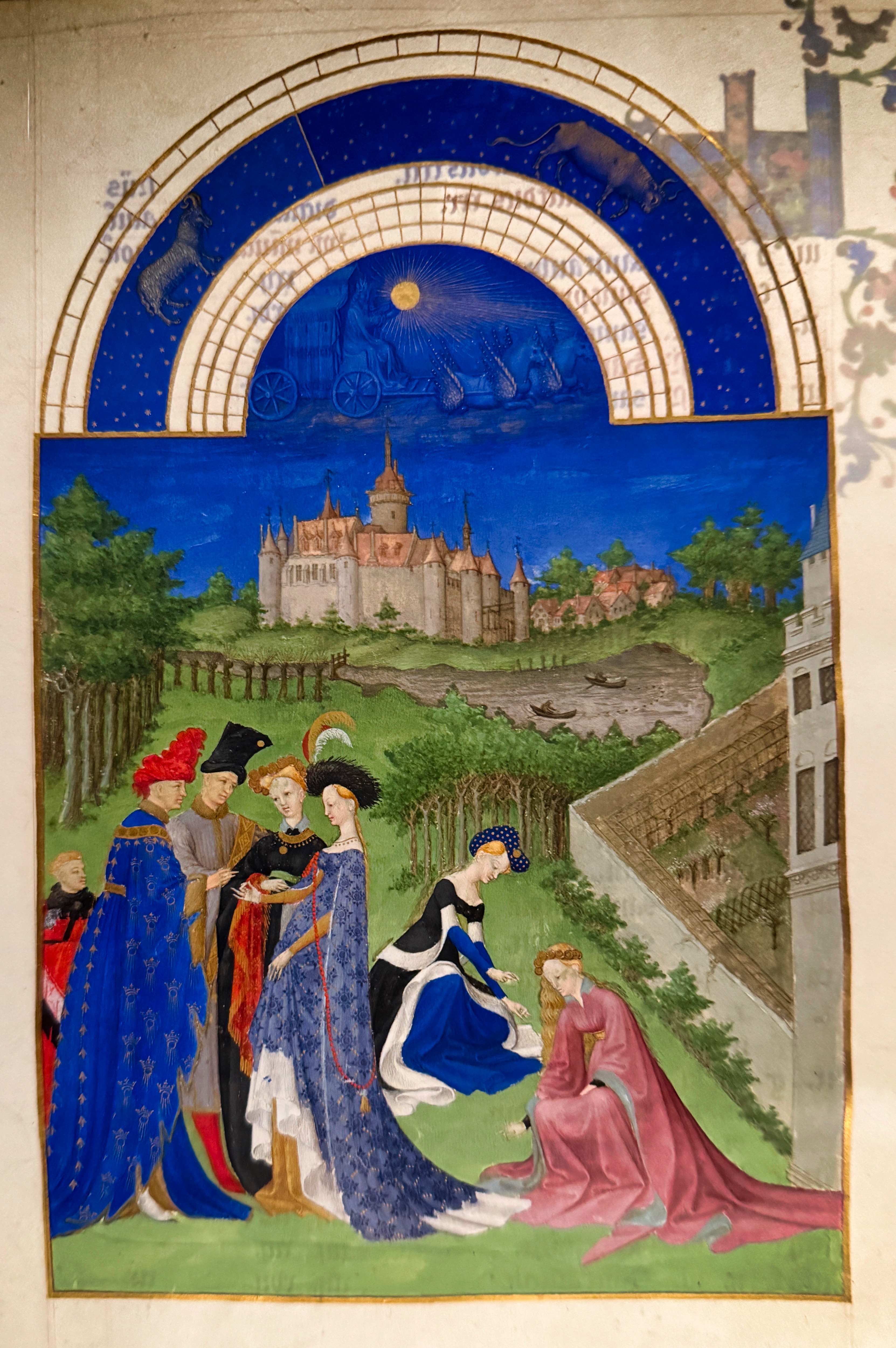
’Les très riches heures de duc de Berry’ is focused around the illuminations of months that depict medieval life around the year with magnificent castles in the background – most of these belonged to the good duke. Below are some of the month illuminations, June, September, March and April.

Latest posts:

NE Greenland National Park

The Northeast Greenland National Park is the world´s largest at 972 000km2. The interior is covered by the Greenland ice sheet, but the coastal areas are ice free in the summer. There is no permanent population, only military and research posts with changing staff.

The most accessible parts of the park are in the southeast, around Kong Oscar Fjord and Kejser Franz Joseph Fjord. The Holm Bugt is on the northern side of the Kong Oscar Fjord, on Traill Island (below).

The conditions here are harsh, so life here is limited to only a few species that have adapted to them, like polar bear, musk ox, arctic hare (below), lemmings, the snowy owl and a few others. Also the vegetation is sparse and at the end of summer, there is nothing uch to eat except roots. On clear nights Northern Lights are common at these latitudes (below).

The Segelsällskapets Fjord was named after the Royal Swedish Yacht Club by a Swedish explorer. It is off the Kong Oscar Fjord, and known for its geological formations (below).

The Blomsterbugt (below) is at the western end of Ymer Island, between the Kong Oscar and Kejser Franz Joseph Fjords.

The Waltershausen Glacier (below) is at the end of Nordfjord. It was named after the German geologist who surveyed it in 1869-70.

The Myggbukta is a bay in the larger Foster Bugt, getting its name from the wet coast that is optimal for mosquitoes in the summer. There is an old Norwegian weather station here, erected at the time when Norway tried to claim this part of Greenland.

Latest posts:

Ittoqqortoormiit, Greenland

Ittoqqortoormiit is one of the world’s remotest settlements, on the east coast of Greenland, with a population of about 350. The name means ’big house dwellers’ and it was founded by a Dane, Ejnar Mikkelsen (his memorial is below left) and 85 inuits, in 1925.

The village lives on services, hunting and fishing, and dogs are an essential part of life (below). The settlement can only be reached by ship or helicopter, which makes provisioning difficult.

The colouring of the houses was originally designed to reflect their use (municipal, healthcare, etc.), but frequent changes mean that this convention isn’t followed any more.

A traffic jam here consists of two quads passing each other (below left) and if things get out of hand, there is a police station (below right).

Although tourist infrastructure is non-existent, there was a dance show for visitors (below).

Previous posts:

Scoresby Sound, Greenland

The Scoresby Sound (or Scoresby Sund in Danish, Kangertittivaq in Greenlandic) is the world’s largest fjord system, where the longest part extends 350 km inland.

The name comes from the English explorer William Scoresby who mapped the area in 1822. The names given to the area are usually descriptive – for example, Bjørneøer (bear islands, pictures below) got the name from the fact that a Danish surveyor shot a bear there.

Similarly, Røde fjord gets its name from the red cliffs lining it (below).

There are polar bears (below upper left), musk oxes (below upper middle), rock ptarmigans (below upper right), arctic foxes, snowy owls and other birds (like the grouses on iceberg below) in the area, but overall the conditions are so harsh that only few species survive here.

The rocky and barren scenery is unforgiving, and Greenland basically only knows winters and summers, very little inbetween. Below icebergs at Sydkap, the mouth of the Nordvestfjord.

Latest posts:

Art Nouveau, Latvian Style

The architecture of Art Nouveau adapted itself to every city that took it on – Barcelona, Helsinki, Nancy, Brussels – developing a set of idioms particular to each city. This also holds for Riga.

The freely flowing continuous decoration, the human form, the often asymmetrical facades are all common Art Nouveau features, but the interpretation in Riga is its own (see above). The architecture is not as experimental as in Barcelona, nor does it focus on flowing lines like Brussels, but is more flowery and decorative than for example in Helsinki.

Above are a few examples of facades from Alberta iela, and below are interiors from the Riga Art Noveau Center.

Latest posts:

The Flåm Railway, Norway

One of the well-known scenic stretches of track, the Flåmsbana between Myrdal and Flåm provides a quick descent from 867m to sea level over 20km in about an hour.

Myrdal s a non-descript stop (above left) on the Oslo-Bergen track, a bit after the highest point of that stretch (which is at 1200m above sea level). The train of the Flåmsbana (above right) requires two modern high-powered engines to clear the steep ascent and descent. If the train is not your thing, apparently the serpentine path (below left) is very popular among cyclists. And there is even a zipline for the adventurous, although the lines in the photo below right are for electricity…

But tourists from all over come here for the rail trip. As Flåm is at the end of Songefjord (above left), it is accessible by huge cruise ships (above right), bringing their human cargo here. And the Norwegians (and others) use Flåm as a starting or ending point of their hike or bike trip (below two images of Flåm).

The scenery along the train route is dramatic, with waterfalls (like Kjosfossen (above left), and deep valleys (above right). Colourful small houses are scattered overall (below left). The track was in planning for decades, and the construction took from 1924 to 1940. It was electrified in 1944 (first electric engine below right).

Previous posts:

The Jungfrau and Its Railways

The Jungfrau Railway (Jungfraubahn) is the highest railway in Europe and takes you from the hamlet of Kleine Scheidegg to Jungfraujoch, the saddle between the peaks of Jungfrau and Mönch at the height of 3454m. The original goal was to add an elevator to the peak (4158m), but this was never done.

The rack railway (above left) is mostly in a tunnel that required considerable manpower and time to build – it was ready after 16 years of work in 1912. And the Swiss are still trying to make the most of the investment – besides viewing platforms with countless selfie opportunities (above right), snow activities (below left) and an ice palace (below right), you can naturally buy your Swiss watch or army knife here.

But most visitors do not start in Kleine Scheidegg – they arrive there with another rack railway, the Wengernalpbahn (below left) from Grinderwald or Lauterbrunnen. These are bigger, but still not on every map. Thus the Berner Oberland-Bahn (below right) takes you to and from Interlaken – and here you can have direct rail connections to all over Switzerland, and the Deutsche Bahn runs an occasional ICE to Berlin and Hamburg.

Of course, if you want to avoid some of the railways, there are cable cars between various points in the area (below left). Whatever your preferred form of transport, the scenery is ridiculously Swiss (below right).


Latest posts are here:

Neuf-Brisach – A Perfectly Formed Town

Neuf-Brisach might not be very big, but at least it is perfectly symmetrical. The reason, naturally, is that it was designed and built at one go – no natural growth here (see the plan below).

The town was built around 1700 by Louis XIV’s famous fortification guru, Vauban (before ennobling called Sébastien Le Prestre). He stares at you in front of the town hall (below left). To keep the local fauna happy, they have reserved an observation post for storks on the roof, also (below right).

The name indictes that there should be an old version of the town somewhere – and there is. The original is called Breisach, and is located on the other side of the Rhine in Germany. The need for a new version of a fortified town arose after the French lost the original. Of course, a fortified town needed a permanent military presence, and caserns were built for this (below left, under renovation). The four gates are well-preserved (below right).

The town has been on the road of various armies from the revolutionary wars to the Second World War, and Vauban’s fortifications have lost some of their lustre in the process (below).

The street scene is no different from any other small French town (below), although street signs are also written in Alsatian.

Previous posts: